Interviewing Denis Ogwal Okello
Interview by Amanda Gibbins
Okello works as the program manager for WASH at GLOFORD Uganda. He is also a data manager for mWater.
He recently travelled to Zimbabwe with two other mWater managers, to train Zimbabwean personnel in the mWater app and portal.

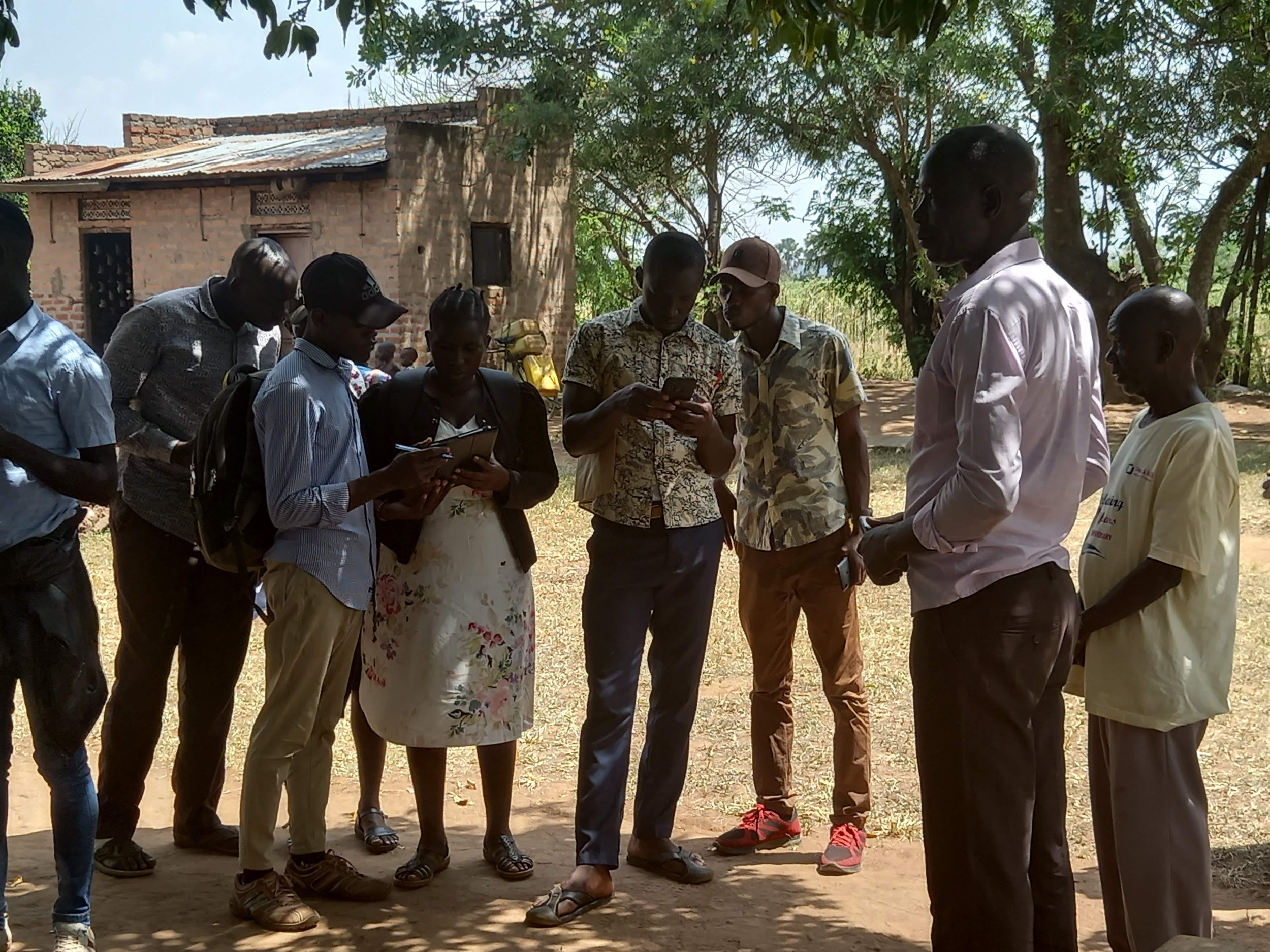
mWater members Binepe Bwambale, Hope Anette Namaganda, Denis Ogwal Okello and Dr. Sydney Hubbard in Zimbabwe
Can you tell me more about your work that you do with mWater?
My name is Okello Denis Ogwal, and I work with mWater as a data manager. We started interacting with mWater early this year when mWater came to Lira. Annie connected to GLOFORD through one of our engineers at the Ministry of Water, as she was looking to get young people involved. GLOFORD is a youth serving NGO, most of our programming is targeting the well being of the young people.
What work have Ugandan young people done with mWater?
In Lira, we recruited fifty graduates and students from Lira University, and trained them on the platform. Ellen Greggio from mWater came here and conducted the training together with Dr. Annie.
After the training, we assessed the young people, and picked out the thirty who had the best interaction with the app, and a fair understanding of the questionnaires that we were using. Then we deployed them, using our knowledge of the region and our networks. We sent them in pairs, so they could support one another, but also for security.
Each time we deployed young people into a community we provided them with the contacts of the parish chief, and the LCs of the villages they were going to. We also gave them real time technical help from our call center. If the contacts we gave them were not going through, I would find an alternative contact. If their support person was not available, we would find a replacement. And in the unlikely occurrence of a misunderstanding in the villages where someone wants to know ‘What is it exactly this young man has come here to do in my village? Why is he collecting this data?’ we were in the call center, answering those questions.

After the household surveys, we entered the water point mapping phase, where we only needed twenty young people. With Ellen, we looked at accuracy and completeness of the data gathered, and in that way selected the best people to map the water points.
It was at this time we brought in Hope Annette Namaganda. At first she was a student from the university who did data collection in Lira. We brought her on board after seeing how consistent she was in her work.
When we moved to Pader, it was myself, Bwambale and Hope from GLOFORD. We sat with a district water officer and the technical staff to plan the activity. We convinced the leaders we met and explained to them what we were going to do. The district wanted their young people to be the ones doing the data collection. Unfortunately it was towards an examination period and we couldn't get students or graduates from there. So we ran adverts over the radio stations. We even invited the resident district commissioner, the district water officer, and the district health officer, together with the three of us from GLOFORD. We were doing this because the area is sometimes known to be unsafe, and we wanted to be sure everyone knew what was happening and that the district was in full support of the activity. It was also to tell people that they could welcome the young data collectors.
Training app use
The following day, we trained the young people on the app, the questionnaires and other technical things such as borehole parts, water systems and different water point technology. Then of course we had practical sessions on how to create sites, how to start surveys. The third day was a full field day, we went out to try to locate the water points in their apps and fill out the surveys. After all that, we convened together, and had a feedback session where they shared their challenges.
When we deployed them in pairs, in every parish we also had the technicians who repair boreholes and work on the wells in the villages. We would call this person and inform them that we were sending a young person there, and to please receive them and direct them to all the water points. Again, this is someone who repairs all the water points in this parish so working with them was very important because they knew water point locations and types, as well as knowing the local LCs and water users.
There were big discrepancies between recorded water points and actual availability, weren’t there?
In Pader, the technicians were able to consult with the LCs, and also confirm if water points existed or if they had been abandoned during the war. Pader is in an area which has camps of internally displaced people, and many NGOs have drilled water points in that area, but these have now been abandoned. And most of these we recommended for decommissioning, for many reasons. Maybe the well was left open, maybe the water points were not there anymore, or the road network now ran over the water points.
I believe that it has really opened the eyes of the government to do more investment on water supply in the rural setting.
Recently, you've been in Zimbabwe, helping train people there for similar work. Could you tell me more about that?
Dr. Annie gave us notice of work training engineers and the people from Zimbabwe Water Department on the mWater app. We were doing this with consultation and support from the World Bank, they were very helpful of course in the design of the dam prioritization and rehabilitation tool. We joined Dr. Sydney in Rwanda. And we traveled together in Zimbabwe.
So on day one we met the team from the World Bank, the developers of the dam rehabilitation prioritization tool. They had worked with the government for some time to develop this tool. We sat together with them to understand the main aim, purpose, and goals for this data collection.
Then we started the training. Our overall leader and coordinator was Dr. Sydney of mWater, but we worked together and trained everyone on the app. Second day we went out into the field. We provided on site support to each one of them. We went to a dam and they tried to locate the dam. After locating the dam we looked at the site information, and edited as appropriate. Then they would start the form for the prioritization and rehabilitation tool.
One thing that is actually very important about this is we appreciated the type of dams that are there in Zimbabwe. It is very rare of course in Uganda to see big dams like that. So we looked at all the different types of dams, and we also went to irrigation schemes to map them in the system. One of the things that is left is for the team to get back and design a form for irrigation systems.
In Zimbabwe it was really amazing. We had very active young people take it up. You know young people are very sharp with technology. They were so energized, and very active. They really wanted it so much.

Our last day there we trained the attendees on using dashboards, visualizations, site approval, de-duplication, indicators, and granting different permissions to different users. These are people who want to use this data immediately. We also taught them how to carry out training sessions themselves, because the hope is for this scheme to be cascaded to the rest of Zimbabwe.
Do you think mWater should be rolled out to more areas?
It is really needed that we roll out this exercise of water point mapping in the entire country. It is needed so that the data is cleaned and the minister gets to know the reality of what is on ground. District water officers want this in their districts.
In Zimbabwe, all the remarks were saying that this really needs to be cascaded to other catchments.